Instructions:
Record the crash location, formatted as degrees.minutes.seconds + compass direction for both N/S and E/W.
Definition:
The crash location latitude and longitude coordinates, obtained by GPS or mapping.
Rationale:
This element is critical for problem identification, prevention programs, engineering evaluations, mapping, and linkage purposes. The location information in a crash file must be capable of being linked to location information in other traffic records systems to study site-specific safety issues. The optimum method for recording crash locations is by Lat/Long coordinates, which are universal. Important for evaluating and comparing crash locations.
| Example |
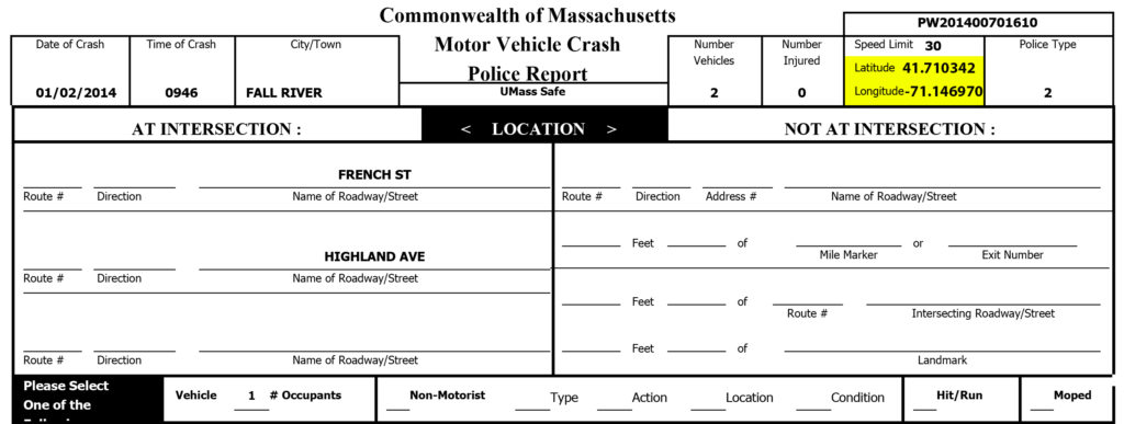 |
FAQ
How can I determine latitude/longitude?
Use the tools provided by your department, or an online resource.
Accuracy Checks
- Values should be within the state range of approximately 42.xx latitude and -71.xx longitude, based on the state boundaries.
Data Quality Audit Results
| Report Type | Complete | Incomplete | ||
| Local Police (electronic) | 8 | 2.3% | 340 | 97.7% |
| Local Police (paper) | 9 | 2.5% | 352 | 97.5% |
| State Police (electronic) | 282 | 84.4% | 52 | 15.6% |
| Total | 299 | 28.7% | 744 | 71.3% |
Latitude/Longitude were fields where consistency could not be verified. For this reason, only completeness was examined. As shown in the table, this field was complete in 29 percent of reports reviewed. Local police completed this field less than 3 percent of the time, while State Police populated the Latitude/Longitude field 85 percent of the time. However, often 0.00 was filled in. Furthermore, conversations with MassDOT auditors indicated that the completed entries were often inaccurate.